
-

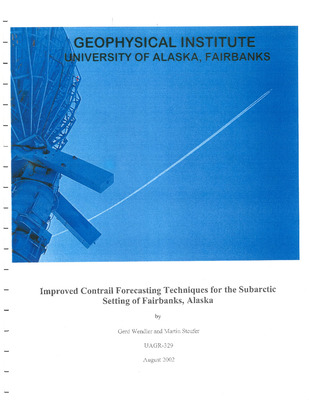
Improved contrail forecasting techniques for the subarctic setting of Fairbanks, Alaska
Gerd Wendler, Martin Steufer, Blake Moore, J. Boussard, C. Cole, J. Curtis, S. Nakanishi, M. Robb, and H. Stone
Jet contrails can be frequently observed in the subarctic setting of Fairbanks, Alaska, much like in the contiguous United States. Since March of 2000, continuous digital imagery of the sky was obtained, supported by FAA flight data and radiosonde ascents at the Fairbanks International Airport. There were a total of 2504 over-flights (March 2000-July 2002) at Fairbanks, but for a great number of these, contrail observations were not possible due to clouds and/or darkness. For 590 cases, the formation of contrails could be confirmed; their life span varied widely from a few seconds to several hours. In general, cold temperatures and high relative humidity at flight level favored the formation of contrails. These conditions are frequently found in the upper troposphere close to the tropopause. Using our substantial database, different existing algorithms were tested and, in part, improved in order to predict contrail formation and lifetime. The best results were obtained with an algorithm described by Schumann (1996) and an aircraft specific contrail factor of 0.036 g/kgK. For contrails within 4 hours of the radiosonde ascents, a combined hit rate for correctly forecasting the occurrence and non-occurrence of contrails of 92% was obtained.
-

Late winter snow and ice characteristics of first-year floes in the Bellingshausen and Amundsen Seas, Antarctica : results of investigations during R.V. Nathaniel B. Palmer cruise : NBP 94-5 in August and September 1993
M. O. Jeffries, A. P. Worby, Kim Morris, W. F. Weeks, B. Hurst-Cushing, R. Jaña, and H. R. Krouse
In August and September 1993, the R. V. Nathaniel B. Palmer operated for 37 days in the pack ice of the Bellingshausen and Amundsen seas supporting a sea ice research program, which included snow cover characterization, snow and ice thickness measurements and ice core analysis. The objective of the study was to improve our knowledge of the conditions and processes that contribute to first-year sea ice development and ice thickness variability in this region, and their impact on active microwave backscatter from the ice. The mean snow density was 247kg/m3. The principal snow type was composed of facetted crystals and depth hoar (48%), indicating strong temperature gradient metamorphism had been common. Ice layers (9%) indicated that snow metamorphism also included melting. Wet snow and slush layers (6%) at the base of the snow cover, with a mean salinity of 21.6‰, were due to seawater flooding of the snow/ice interface and brine wicking. Negative freeboard values, i.e., the water level was above the ice surface which was flooded with seawater, occurred at 18% of the drill holes on the snow and ice thickness transects. The majority of snow depth values (76%) ranged from 0.05-0.35m. The mean snow depth value was 0.23 ±0.16m. The majority of ice thickness values (62%) ranged from 0.3-0.8m. The mean ice thickness was 0.90±0.64m. Both the ice thickness and snow depth probability density functions have long tails of high values: the ice thickness distribution due to thickening by rafting and ridging, and the snow depth distribution due to snow drift formation on the flanks of ridge sails and other protuberances at the surface. In addition to the widespread flooding of the snow/ice interface, there was strong flooding potential as indicated by the large number (59%) of freeboard values in the range 0-0.05m. Three types of floe, X, Y and Z, are classified according to their coefficients of ice thickness variation. Their snow depth, ice thickness, draft and freeboard characteristics, and structural composition are described. Ice <0.5m thick was colder (mean temperature: -3.9°C) than ≥0.5m thick (mean temperature: -2.8°C), mainly because it had a thinner snow cover and was, therefore, less well insulated from the atmosphere than the thicker ice. Ice <0.5m thick was also more saline (mean salinity: -7.3‰) than ice ≥0.5m thick (mean salinity: 5.6‰), primarily because the thicker ice was older and had undergone greater brine loss. The temperature-ice thickness and the salinity-ice thickness relationships each have an abrupt change of slope at 0.5m. In ice ≥0.5m thick, mean core salinity was largely independent of ice thickness and generally lower than Arctic ice of similar age and thickness. The composite salinity profile for ice <0.5m thick was close to the C shape that is typical of Arctic first-year ice. Ice ≥0.5m thick, however, had a characteristic S shape profile with the highest values at the top due to snow ice formation, and a trend to lower values towards the bottom due to brine loss. Much of the brine loss may have been due to gravity drainage, since the majority of brine volumes were >5%, a value at which brine pockets coalesce and gravity drainage occurs. Ice crystal texture and δ¹⁸O values show that the major structural components of the floes were frazil ice (44%), congelation ice (25%) and snow ice (25%). The frazil ice originated primarily in the pancake cycle. Frazil and congelation ice layers both had an average thickness of 0.12m, indicating that neither reached a substantial thickness by thermodynamic growth alone; each thickened primarily by dynamic processes, i.e., deformation. The snow ice layers had a mean thickness of 0.2m and indicated that, by the end of winter, the thermodynamic development of the ice cover was dominated by seawater flooding of the snow/ice interface and snow ice formation. Snow ice layers were composed of 7-13% snow, which contributed to 2-4% of the total ice mass.
-

Blue jets, blue starters & sprites over a severe storm in Arkansas, July 1, 1994
Eugene M. Wescott and Davis D. Sentman
-

A study of the link between cloud microphysics and climate change
Yong-Xiang Hu
The climate related cloud radiative properties (fluxes and heating rates) are found to be determined by the second and the third moments of the cloud droplet size distribution. The detailed distribution of the cloud droplet size is unnecessary to obtain for climate purposes. An accurate parameterization of cloud optical properties suitable for climate models is developed. A new radiative-convective model has been developed and used for studying cloud-climate interactions. The energy balance at the Earth-atmosphere interface is treated in a self-consistent manner which avoids artificial tuning. The cloud radiative properties are accurately incorporated and are suitable for sensitivity studies of cloud-radiation-climate interactions. A sensitivity study of role of the cloud microphysical properties in the climate system is performed by studying the impact of cloud radiative forcing on the equilibrium state temperature. The cloud equivalent radius is found to be a very important variable in the climate system. A climate sensitivity study is performed to highlight the important role of the cloud absorption. An adjoint radiative transfer method is developed for use in the cloudy and aerosol-loaded atmospheres. The physical meaning of the adjoint radiative properties are discussed. The method is expected to be useful in climate modeling and remote sensing studies. A preliminary study of the atmospheric irreversibility is performed to elucidate the connection between cloud microphysical properties and the macrophysical direction of global climate. A variational principle which describes the macrophysical character of the climate system is established.
-
Red sprites & blue jets : initial observations of high altitude atmospheric flashes above thunderstorms from the Sprites Campaign
Daniel L. Osborne
Describes the Sprites Campaign which utilized two aircraft to record the phenomenon, red sprites, above thunderstorm clouds; also describes blue jets that were observed and recorded for study.
-

Radiation transport in cloudy and aerosol loaded atmospheres
Arve Kylling
The equation for radiation transport in vertical inhomogeneous absorbing, scattering, and emitting atmospheres is derived from first principles. It is cast in a form amenable to solution, and solved using the discrete ordinate method. Based on the discrete ordinate solution a new computationally efficient and stable two-stream algorithm which accounts for spherical geometry is developed. The absorption and scattering properties of atmospheric molecules and particulate matter is discussed. The absorption cross sections of the principal absorbers in the atmosphere, H₂O, CO₂ and O₃, vary erratically and rapidly with wavelength. To account for this variation, the correlated-�� distribution method is employed to simplify the integration over wavelength necessary for calculation of warming/cooling rates. The radiation model, utilizing appropriate absorption and scattering cross sections, is compared with ultraviolet radiation measurements. The comparison suggests that further experiments are required. Ultraviolet (UV) and photosynthetically active radiation (PAR) is computed for high and low latitudes for clear and cloudy skies under different ozone concentrations. An ozone depletion increases UV-B radiation detrimental to life. Water clouds diminish UV-B, UV-A and PAR for low surface albedos and increase them for high albedos. The relative amount of harmful UV-B increases on overcast days. The daily radiation doses exhibit small monthly variations at low latitudes but vary by a factor of 3 at high latitudes. Photodissociation and warming/cooling rates are calculated for clear skies, aerosol loaded atmospheres, and atmospheres with cirrus and water clouds. After major volcanic explosions aerosols change O₃ and NO₂ photodissociation rates by 20%. Both aged aerosols and cirrus clouds have little effect on photodissociation rates. Water clouds increase (~ 100%) photodissociation rates that are sensitive to visible radiation above the cloud. Solar warming rates vary by 50% in the stratosphere due to changing surface albedo. Water clouds have a similar effect. The net effect of cirrus clouds is to warm the troposphere and the stratosphere. Only extreme volcanic aerosol loadings affect the terrestrial warming rate, causing warming below the aerosol layer and cooling above it. Aerosols give increased solar warming above the aerosol layer and cooling below it.
-

Nearshore ice conditions from radar data, Point Barrow area, Alaska
Lewis H. Shapiro and Ronald C. Metzner
From June, 1973 to May, 1979, the University of Alaska maintained a small radar system to monitor near shore ice motion and conditions at the Naval Arctic Research Laboratory near Point Barrow, Alaska. The purpose was to support research projects which required that information. In this report, the data acquired are compiled to describe the annual cycle of the ice year in the area. A short open water season can be defined as extending from late-July to late-September. This is followed by freezeup, which is characterized by a decreasing frequency of occurrence of drifting pack ice in the area between October and January. The winter season extends from January through May and is marked by generally stable or slow-drifting pack ice, or by the absence of pack ice offshore from the edge of the fast ice. The onset of breakup in June is characterized by the increasing occurrence of drifting pack ice again. Comparison of the ice cycle with climatologic data indicates no strong correlations with variables other than (possibly) air temperature. As expected, ice activity is greatest during freezeup and breakup, with rapid changes in the directions and velocity of ice motion. Similar movement patterns occur in winter, but the ice velocities are slower. Data of the type generated by the radar system would be useful for any area in which development of offshore installations is planned. Clearly, a knowledge of the range of possible ice motion patterns and events can provide the basis for improving the design of such installations.
-

Electrical conductivity, freezing temperature, and salinity relationships for seawater and sodium chloride solutions for the salinity range from 0 to over 200 PPT
Grant Cody Baker
Algorithms for the conversion of electrical conductivity to salinity (and vice-versa) for seawater and sodium chloride solutions were developed. Algorithms developed for seawater were based on laboratory measurements of synthetic seawater were based on laboratory measurements of synthetic seawater solutions and are valid for the salinity range from 0 to about 212 ppt at temperatures of 15, 20 and 25°C. Algorithms developed for NaCl solutions were based on literature data and are valid for the salinity range from 0 to about 250 ppt at temperatures of 20 and 25°C. Previous work by others for the conversion of salinity to the freezing temperature for seawater solutions is discussed. From this work, expressions for the conversion of the freezing temperature to salinity were derived and are given for the salinity range from 0 to about 230 ppt. Algorithms for the conversion of salinity to the freezing temperature (and vice-versa) for sodium chloride solutions were developed, based on literature data, for the salinity range from 0 to about 230 ppt.
-

Stratigraphy, petrology, and geochemistry of the Spurr Volcanic Complex, eastern Aleutian Arc, Alaska
Christopher J. Nye
The Spurr Volcanic Complex (SVC) is a calcalkaline, medium-K, sequence of andesites erupted over the last quarter of a million years by the easternmost currently active volcanic center in the Aleutian Arc. The ancestral Mt. Spurr was built mostly of andesites of uniform composition (58-60% SiO₂), although andesite production was episodically interrupted by the introduction of new batches of more mafic magma. Near the end of the Pleistocene the ancestral Mt. Spurr underwent Bezymianny-type avalanche caldera formation, resulting in the production of a volcanic debris avalanche with overlying ashflows. Immediately afterward, a large dome (the present Mt. Spurr) was emplaced in the caldera. Both the ashflows and dome are made of acid andesite more silicic than any analyzed lavas from the ancestral Mt. Spurr (60-63% SiO₂), yet contain olivine and amphibole xenocrysts derived from more mafic magma. The mafic magma (53-57% SiO₂) erupted during and after dome emplacement, forming proto-Crater Peak and Crater Peak. Hybrid pyroclastic flows and lavas were also produced. Proto-Crater Peak underwent glacial dissection prior to the formation of Crater Peak in approximately the same location. The vents for the silicic and mafic lavas are in the center and in the breach of the 5 by 6 km horseshoe shaped caldera, respectively, and are less than 4 km apart. Late Holocene eruptive activity is restricted to Crater Peak, and magmas continue to be relatively mafic and derived from deep within the crust. SVC lavas are plag ± ol + cpx ± opx + mt bearing. All post-caldera units contain small amounts of high AL₂O₃, high alkali pargasite, and Proto-Crater Peak and Crater Peak lavas contain abundant pyroxenite and anorthosite clots presumably derived from an immediately pre-existing magma chamber. Ranges of mineral chemistries within individual samples are often nearly as large as ranges of mineral chemistries throughout the SVC suite, suggesting that magma mixing is common. SVC lavas are unlike experimentally produced cotectic liquids and are thus unlikely to be related to each other by fractional crystallization. Magmatic evolution must instead be controlled in large part by crustal assimilation. Flat Y-SiO₂ and Nb-SiO₂ trends and Rb enrichment beyond that which can be reasonably modeled by fractional crystallization also suggest extensive assimilation of lower crust, bulk upper crust, or partial melts of local batholithic material. Since at least the mid-Holocene there has been no shallow, silicic magma chamber at the SVC. This increases the expectation that the low resistivity layer described by Turner and Wescott (1986) is a highly conductive layer of bedrock, such as a thick, altered tuff.
-

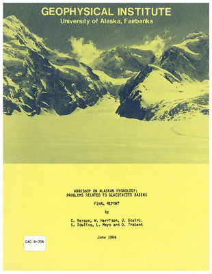
Workshop on Alaskan Hydrology : problems related to glacierized basins : final report
Carl S. Benson, William Harrison, Sue Ann Bowling, Dennis Trabant, Larry Mayo, and Joan P. Gosink
This report summarizes the results of the international Workshop on Alaskan Hydrology: Problems Related to Glacierized Basins, held in Eagle River, Alaska, during April, 1985. Hydrology in Alaska is strongly influenced by problems associated with snow, ice and permafrost which will become increasingly important as economic development proceeds. The Scandinavian countries, Switzerland and Canada have preceded Alaska in developing hydrological resources that depend on glaciers for their sources, and Alaskans can learn from their experience. The international workshop sought to capitalize on this expertise and experience from abroad, and to help bridge the communication gap between scientific and engineering/management groups by having both groups participate. The subjects considered were: runoff from glacierized basins, sediments in glacial streams, hazards associated with glaciers, ice problems on rivers and reservoirs, and selected aspects of permafrost hydrology in glacierized basins. Two days of the workshop were devoted to presentations by the participants, followed by intensive meetings of five subgroups. This report contains the conclusions and recommendations of the subgroups, a list of participants, summaries of presentations, and bibliographic material.
-

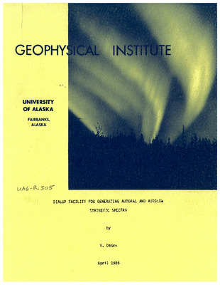
Dialup facility for generating auroral and airglow synthetic spectra
Vladimir Degen
The DIALUP project was initiated to provide the scientific community with a user-friendly, remotely accessible facility of generating synthetic molecular spectra of interest in studies of the aurora and airglow, using the computer codes currently in use at the University of Alaska Geophysical Institute as the theoretical database. A pilot setup was demonstrated successfully at the GBOA (Ground-Based Optical Aeronomy) June 1985 workshop in Seattle, Washington via telephone link to Fairbanks, Alaska. This report describes the set-up and operation of the system.
-

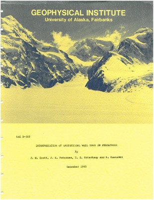
Interpretation of geophysical well logs in permafrost
J. H. Scott, J. K. Petersen, T. E. Osterkamp, and K. Kawasaki
This report is a collection of information on the interpretation of well logs and borehole geophysical surveys in permafrost. The body of the report is preceded by an executive summary that gives the highlights of the report in condensed form. The introductory chapter contains background information that is fundamental to the understanding of well log applications in permafrost, including definitions and descriptions of well logs, permafrost, and related terms, and illustrations showing the extent of permafrost in Alaska. Chapter 2 presents information on physical properties of permafrost that relate to well log interpretation, including porosity and pore-filling media (water, ice and air), and their effects on thermal properties, electrical properties and acoustic properties. Chapters 3-8 describe the following types of well logs in detail, including measurement principles and methods, procedures for calibration and interpretation, and identification of special problems related to permafrost: thermal logs, electric logs, sonic logs, nuclear logs, magnetic logs, and miscellaneous (caliper and drilling) logs. Chapter 9 gives information on three types of borehole geophysical surveys, electrical resistivity, seismic velocity, and borehole gravity, with emphasis on the increased depth of investigation afforded by these surveys as compared with well logs. Chapter 10 described a number of specific applications, including the identification of lithology in permafrost, characterization of the thermal regime and the thermal properties of permafrost, petroleum exploration and production, mining applications, and geotechnical applications. A concluding chapter summarizes the information contained in the body of the report and includes a table that gives an overview of the relative value of various borehole geophysical measurements that can be used for delineating and characterizing permafrost. Conclusions of the report are that a number of standard borehole measurement techniques have been tried and proven in permafrost and can be used effectively to delineate and characterize earth material penetrated by the borehole. However, there are several well logging techniques that have special potential for detecting permafrost that have not been tested: dielectric constant, sonic waveform, televiewer, and nuclear magnetic resonance. Borehole electrical and seismic surveys have potential for detecting permafrost at large distances from the borehole, and these techniques need further development and refinement to take full advantage of their capability.
-

Cold regions air pollution : bibliography and summary
Gunter E. Weller, Carl S. Benson, Sue Ann Bowling, Thomas A. Gosink, Takeshi Ohtake, Glenn E. Shaw, and Thomas E. Moyer
-

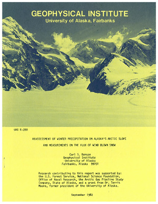
Reassessment of winter precipitation on Alaska's arctic slope and measurements on the flux of wind blown snow
Carl S. Benson
This research indicates that the existing long-term weather records for snow precipitation on Alaska’s Arctic Slope are too low by a factor of three. The flux of wind blown snow and its average transport distance have also been determined for the major wind directions and averaged over seventeen years of measurement.
-

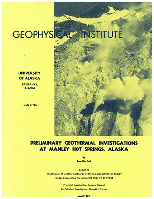
Preliminary geothermal investigations at Manley Hot Springs, Alaska
Jennifer East
Manley Hot Springs is one of several hot springs which form a belt extending from the Seward Peninsula to east-central Alaska. All of the hot springs are low-temperature, water-dominated geothermal systems, having formed as the result of circulation of meteoric water along deep-seated fractures near or within granitic intrusives. Shallow, thermally disturbed ground at Manley Hot Springs constitutes an area of 1.2 km by 0.6 km along the lower slopes of Bean Ridge on the north side of the Tanana Valley. This area includes 32 springs and seeps and one warm (29.1° C) well. The hottest springs range in temperature from 61° to 47° C and are presently utilized for space heating and irrigation. This study was designed to characterize the geothermal system present at Manley Hot Springs and delineate likely sites for geothermal drilling. Several surveys were conducted over a grid system which included shallow ground temperature, helium soil gas, mercury soil and resistivity surveys. In addition, a reconnaissance ground temperature survey and water chemistry sampling program was undertaken. The preliminary results, including some preliminary water chemistry, show that shallow hydrothermal activity can be delineated by many of the surveys. Three localities are targeted as likely geothermal well sites, and a model is proposed for the geothermal system at Manley Hot Springs. Water circulates through biotite granite of the Hot Springs Dome stock and then migrates upward through hornfelsed sedimentary rocks of the informally named “Boulder Ridge Formation.” The springs issue from loess deposits of approximately 5 to 30 meters in thickness. The loess may act as an impermeable caprock allowing thermal water to reach the surface along fractures. The study did not conclusively recognize a controlling fault or fault system at Manley Hot Springs. Some evidence suggests that faults may be present, but they are well-masked by alluvial and vegetative cover. Follow-on studies suggested include more extensive helium surveying, galvanic resistivity and a seismic survey.
-

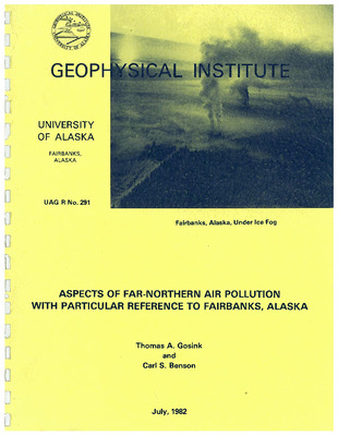
Aspects of far-northern air pollution with particular reference to Fairbanks, Alaska
Thomas A. Gosink and Carl S. Benson
This report provides an insight into the principal meteorological factors influencing air pollution in Fairbanks, gives an up-to-date review of the principal components found in local air pollution, and identifies areas in which further research is necessary.
-

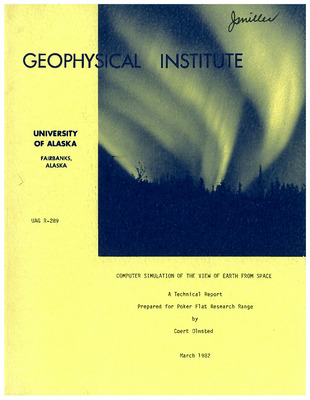
Computer simulation of the view of earth from space : a technical report
Coert Olmsted
The computer program, using a vector graphics system, produces a line drawing of the image of the earth as it would appear to an observer with a given direction of view and a given position above the surface of the earth. Features plotted include a latitude-longitude grid, cities and towns, coastlines, islands, lakes and rivers. Points above the surface of the earth may be plotted as well but no hidden line analysis is performed for such features.
-

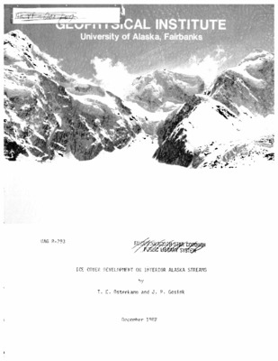
Ice cover development on interior Alaska streams
T. E. Osterkamp, J. P. Gosink, and Joan P. Gosink
A number of photographs are presented which illustrate selected aspects of frazil ice formation in turbulent Interior Alaska streams. These include the various forms of frazil ice found in turbulent streams and the processes involved in the development of an ice cover on the streams. All of the photographs depict frazil ice under field conditions. They include photographs of cooling conditions, frazil discs (both in situ and removed from the stream), anchor ice, edge ice, frazil flocs, frazil pans, snow slush, and frazil floes. Photographs of hydrological conditions that lead to the production of large frazil ice floes and of different types of frazil ice jams are also included. These photographs provide visual documentation of the key role that frazil ice plays in ice cover development on turbulent streams in Interior Alaska.
-

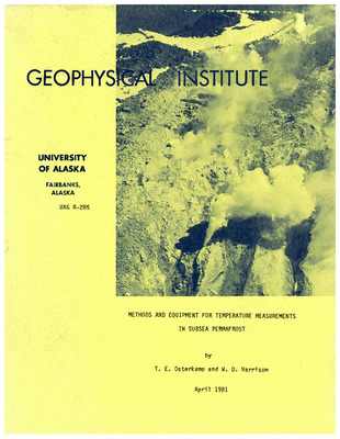
Methods and equipment for temperature measurements in subsea permafrost
Thomas E. Osterkamp and W. D. Harrison
Temperature measurements have been made since 1975 in shallow, small-diameter boreholes in the subsea sediments of the Bering, Chukchi and Beaufort Seas off the coast of Alaska. Methods for making access holes with lightweight equipment are described. These include augering, water jet drilling, rotary water jet drilling, and driving. The holes were completed with iron or plastic water pipe or with plastic tubing and logged for temperature at discrete, closely spaced intervals. Methods for the calibration and use of the temperature-measuring equipment and for the reduction of temperature data are also described.
-

Electron transport and energy degradation : on the numerical solution to the two-stream equations
Knut Stamnes
A new numerical solution to the two-stream equations for electron transport and thermalization is presented and discussed. The numerical code is verified by comparing computed results with the analytic results of Stamnes (1981) and with the Nagy-Banks code (Nagy and Banks, 1970). Further verification is provided by carefully testing for energy conservation. The computational speed depends primarily on the number of grid points in altitude utilized. It is demonstrated that useful results can be obtained with as little as 20-40 altitude grid points. The present numerical code represents an extension of the Nagy-Banks code to high electron energies appropriate for auroral applications. This extension is accomplished by using the energy degradation method of Swartz (1977) and the backscatter ration of Stamnes (1981).
-

On the discrete ordinate method for radiative transfer calculations in anisotropically scattering atmospheres : intensity computations
Knut Stamnes and Henri Dale
The recently developed matrix method to solve the discrete ordinate approximation to the radiative transfer equation in plane parallel geometry (Stamnes, 1980) is extended to compute the full azimuthal dependence of the intensity. Comparing computed intensities with those obtained by other established methods, we find that for phase functions typical of atmospheric haze 32 streams are sufficient for better than 1% agreement, while 16 streams yield an accuracy of about 1-5% except for angles close to the forward and backward directions for which the error is about 10-15%. The results of the intensity computations are summarized by presenting three-dimensional “stack plots” of the intensity as a function of polar and azimuthal angles. We also show that for flux calculations 4 streams suffice to obtain 1% accuracy, while 8 streams yield an accuracy better than 0.1%.
-
 Wescott and Donald L. Turner")
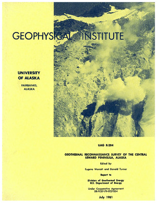
Geothermal reconnaissance survey of the central Seward Peninsula, Alaska
Eugene (editor) Wescott and Donald L. Turner
Summary: The central Seward Peninsula was the subject of a geological, geophysical and geochemical reconnaissance survey during a 30-day period in the summer of 1980. The survey was designed to investigate the geothermal energy resource potential of this region of Alaska. Based upon our previous work (Turner and Forbes, 1980) and the 1980 survey, we have proposed a continental rift system model to explain many of the Late Tertiary-to-Quaternary topographic, structural, volcanic and geothermal features of the region. Geologic evidence for the model includes normal faults, extensive fields of young alkalic basalts, alignment of volcanic vents, graben valleys and other features consistent with a rift system active from late Miocene time to the present. Rift systems in may parts of the world are known for their abnormal heat flow and significant geothermal potential. Five traverses crossing segments of the proposed rift system were run to look for evidence of structure and geothermal resources not evident from surface manifestations. Gravity, helium and mercury soil concentrations were measured along the traverses. Both helium and mercury soil concentrations have been shown elsewhere to be useful indicators of geothermal resources. We found that mercury soil content varied widely along the traverses and cannot be used to identify areas of interest in the environment of the central Seward Peninsula. Helium in soil gas, however, offers great promise as a geothermal exploration tool. Our surveys found numerous He anomalies that tend to support the rift model. With the exception of two sampling sites, all helium anomalies were found near proposed rift segments. Several areas of significant helium soil gas concentration warrant closer study in any further detailed exploration for geothermal resources. Gravity profiles across the proposed rift segments generally show features consistent with a rift system. One traverse, the Noxapaga, has been interpreted by a two-dimensional model, and can be explained by low density sediments filling a valley 1.25 km deep and 32 km wide. Geologic evidence indicates that this valley is a structural feature (graben). Gravity profiling across the Pilgrim River Valley also appears to agree with a graben structure, as supported by geologic evidence. A long-spaced seismic refraction line was run in the Pilgrim River Valley at Pilgrim Springs to determine the depth to crystalline bedrock. Despite some instrumental problems a depth of 425 m was obtained. Previous depth estimates were much shallower (> 200 m; Turner and Forbes, 1980). The revised depth estimate indicates that deeper geothermal reservoirs may be present and that the reservoir potential of the Pilgrim Springs geothermal resource area may be even greater than was previously estimated (Turner and Forbes, 1980). We also carried out deep resistivity and VLF studies in the Pilgrim River Valley to further our understanding of the nature of the geothermal resources at and outside of the hot springs area. Three-dimensional modelling of galvanic resistivity generally agrees with a shallow reservoir as determined by drilling but does not rule out deeper significant reservoirs in the 425 m of valley fill. VLF and galvanic resistivity measurements confirm the existence of low resistivity (presumably hot saline water) under a zone along the Pilgrim River and under a small thaw zone 4 km northeast of Pilgrim Springs. We found that the VLF EM-16R technique agreed well with galvanic resistivity measurements and could be very useful as a regional exploration tool. A National Aeronautics and Space Administration study of remote sensing techniques in the Central Seward Peninsula was also carried out in 1980, centered on Pilgrim Springs. Radar measurements proved to be useful in locating linear features under the vegetation which are useful in structural mapping and geothermal resource exploration. Thermal infrared imagery disclosed three warm ground zones in the Pilgrim Springs vicinity under less than ideal conditions. However, the interpretation of infrared imagery appears to be too difficult and expensive to be useful in regional studies of significantly larger areas. We did not discover any new geothermal resource areas in our 1980 work. However, we have established that the central Seward Peninsula may contain a continental rift system with some areas of abnormal helium soil gas concentrations and likely abnormal heat flow, suggesting that the geothermal energy potential of the area is high, and that Pilgrim Springs may only be the “tip of the iceberg”.
-

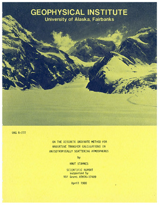
On the discrete ordinate method for radiative transfer calculations in anisotropically scattering atmospheres
Knut Stamnes
The difficulties inherent in the conventional numerical implementation of the discrete ordinate method (following Chandrasekhar’s prescription) for solving the radiative transfer equation are discussed. A matrix formulation is developed to overcome these difficulties, and it is specifically shown that the order of the algebraic eigenvalue problem can be reduced by a factor of 2. This results in considerable reduction of computing time, especially if high-order discrete ordinate solutions are desired. A new expression for the source function is derived and used to obtain angular distributions. By appealing to the reciprocity principle it is shown that substantial computational shortcuts are possible if only integrated quantities such as albedo and transmissivity are required. Comparison of fluxes calculated by the present approach with those obtained by other methods shows that low-order discrete ordinate approximations yield very accurate results. Thus, the present approach offers an efficient and reliable computational scheme that lends itself readily to the solution of a variety of radiative transfer problems in realistic planetary atmospheres.
-

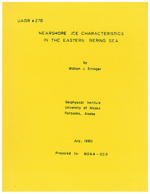
Nearshore ice characteristics in the eastern Bering Sea
William J. Stringer
A description of Bering Sea nearshore ice conditions is presented based on compilation of fast ice edge satellite data, and observations of specific ice events and results from other studies. Landsat imagery at 1:500,000 scale was used to map Bering Sea ice conditions between 1973 to 1976 in nearshore areas. From these maps, secondary single attribute maps were compiled, giving the edge of fast ice at various epochs during these four years. Maps were then compiled on a seasonal basis representative of 1) midwinter, 2) late winter - early spring, and 3) mid-to-late spring. The seasonal average maps were then compared to determine seasonal trends in fast ice edge location. This information was analyzed together with imagery showing specific ice events and bathymetric charts, wind data, tidal variations and observed ice trajectories. The result is a regional description of average nearshore ice conditions along the Bering Sea coast from Cape Prince of Wales to Cold Bay on the Alaskan Peninsula. Over this distance a north-south transition is found from fast ice conditions similar to those in the Beaufort and Chukchi Seas (fast ice bounded by grounded ridge systems located at 20 meters depth), to conditions generated by large tidal variations, offshore winds and highly mobile ice, with the result that fast ice is found only in highly protected, shallow waters.
Printing is not supported at the primary Gallery Thumbnail page. Please first navigate to a specific Image before printing.
