
Files
Download
Download Full Text (3.0 MB)
Description
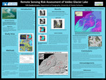
Can remote sensing techniques be used to determine the probability of an outburst from the Valdez Glacier Lake, and to detect downstream areas affected by a possible glacier lake outburst flood?
Publication Date
4-17-2012
Keywords
URSA, Research Day
Recommended Citation
Soederstroem, Erik, "Remote Sensing Risk Assessment of Valdez Glacier Lake" (2012). 2012 Research Day Posters. 52.
https://ualaska.researchcommons.org/uaf_ursa_2012_posters/52
Handle
http://hdl.handle.net/11122/1570